- Write by:
-
Monday, November 23, 2020 - 1:37:16 PM
-
554 Visit
-
Print
Mining News Pro - A new tool that uses satellite radar imagery to capture millimetre-scale measurements of changes in terrain height may help authorities manage public safety and environmental issues in recently abandoned coal mines.
The tool has been developed by researchers at the University of Nottingham and its measurements can be used to monitor and forecast groundwater levels and changes in geological conditions deep below the Earth’s surface in former mining areas.
In a paper published in the journal Remote Sensing of Environment, the researchers explain that when deep mines are closed, the groundwater that was previously pumped to the surface to make mining safe is allowed to rise again until it is restored to its natural level in a process called rebound. This means that those performing this process, whether public entities or private companies need detailed information on the rebound rate so it knows exactly where to relax or where to increase pumping to control groundwater levels and avoid unanticipated flows and discharges.
To provide such detailed information, the team at Nottingham employed an advanced Interferometric Synthetic Aperture Radar (InSAR) technique, called Intermittent Small Baseline Subset (ISBAS), which uses stacks of satellite images of the same location taken every few days or weeks which makes it possible to pick up even the slightest topographical changes over time.
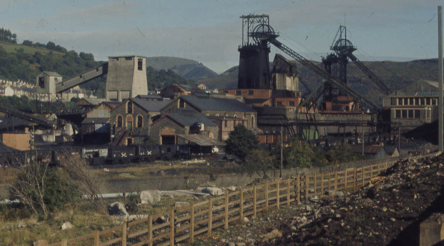
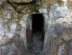
They tested their project in the Nottinghamshire coalfields, which were abandoned as recently as 2015, when the last deep mine, Thoresby Colliery, was shut down.
“Uniquely, ISBAS InSAR can compute land deformation measurements over both urban and rural terrain. This is beneficial when mapping former mining areas, which are often located in rural areas,” the scientists said in a media statement.
Such a density of measurements meant that it was possible to develop a cost-effective and simple method to model groundwater rebound from the surface movement changes. The study found a definitive link between ground motion measurements and rising mine water levels. Often land subsidence or uplift occurs as a result of changes in groundwater, where the strata acts a little like a sponge, expanding when filling with fluid and contracting when drained.
With near-complete spatial coverage of the InSAR data, the researchers were able to fill in the measurement gaps between boreholes to map the change in mine water levels across the whole coalfield. The model takes into account both geology and depth of groundwater to determine the true rate of rebound and help identify where problems associated with rebound may occur.
“InSAR measurements, when combined with modelling, can assist with the characterization of the hydrogeological processes occurring at former mining sites. The technique has the potential to make a significant contribution to the progressive abandonment strategy of recently closed coalfields,” study lead, David Gee, said.
The InSAR findings offer a supplementary source of data on groundwater changes that augment the borehole measurements. It means monitoring can be done remotely so it is less labour-intensive for national bodies managing hazards such as flooding, pollution and contaminated land.
Short Link:
https://www.miningnews.ir/En/News/608466
Anglo American Plc said it is has received an unsolicited non-binding combination proposal from BHP Group.

China’s state planner on Friday finalized a rule to set up a domestic coal production reserve system by 2027, aimed at ...

The world’s coal-fired power capacity grew 2% last year, its highest annual increase since 2016, driven by new builds in ...
Peabody Energy Corp. shares sunk to the lowest in seven months after the biggest US coal miner warned that first-quarter ...
Polish government is abandoning plans to separate coal-fired power plants into a special company and is considering ...

BMO Bank quietly dropped its policy restricting lending to the coal industry in late 2023, helping it avoid being ...
Researchers at the University of Edinburgh discovered that bacteria found in areas polluted by acid mine drainage had ...
BMO Bank quietly dropped its policy restricting lending to the coal industry in late 2023, helping it avoid being ...
Iron ore reversed direction after dropping to its lowest level in 10 months as optimism that the country’s economic ...
No comments have been posted yet ...